Category Archives: Bicycling & Fitness

This is why it is so cool to be a Dane.

This post taken from RoadBiker.com

If you enjoy a post-ride beer you may be increasing the heart-healthy benefits of cycling.

A study in Denmark has found that drinking alcohol in moderation seems to have benefits similar to exercise. This research, reported in Time’s Feb. 4 issue, is significant in that it was conducted on 12,000 people over a 20-year period.
It was found that exercise and drinking alcohol each had an independent beneficial effect on the heart. Mainly, an increase in good cholesterol (HDL) and the removal of fatty deposits created by bad cholesterol (LDL) in blood vessel walls.
The study also determined that drinking and exercise combine to have a greater health benefit than either alone.
The Danish researchers defined four categories and found that . . .

  • people who never drink and don’t exercise had the highest risk of heart disease.
  • people who never drink but do exercise had a 30% lower risk.
  • people who drink moderately but never exercise had a 30% lower risk.
  • people who drink moderately and exercise had a 50% lower risk.
  • Now,before you swap your Endurox for a 6-pack of Pabst, here are the caveats:
    A research team spokesman, Dr. Morten Gronbaek of Denmark>’s National Institute of Public Health, says the benefits of alcohol don’t kick in until you’re at the age — 45 to 50 — where heart disease becomes an appreciable risk. “There’s absolutely no proof of a preventative and protective effect before age 45,” Gronbaek told Time. Further, alcohol consumption is related to an increase in breast cancer among women, and anyone who has a family history of alcoholism should steer clear no matter what their age.

    The study imposed a limit of one drink a day for women and two for men. It did not distinguish among beer, wine and liquor. It calls for common sense in determining a “moderate” amount: a 12-oz. beer and a double martini are far different even though they fit in the same size glass.

    Snowshoe trip on Boy Scout Ridge

    This weeks snow shoe trip started at White River canyon. We hiked past the sledders to and begin our the trek up the canyon and immediately got a great view of Mt. Hood.
    Mt Hood from White River Canyon

    About 200 feet up the river, we headed off through the trees to meet up with the ski trail. This trail is to take us to the Yellow Jacket trail and to the Pacific Crest trail. After the last heavy snow, we could see no tracks of previous hikers, and were apparently the only ones who have chosen this route so far today. If we can, we stick to the marked ski trails. These trails are marked with blue plastic diamonds nailed to the trees. The object here is to find the first one, on the near side of a large tree. Then, based on the angle of the ones posted on the far side of the tree, you should know which direction to head from there. The theory is that you should see another set of markers from very near the previous set. Then simply just follow the markers. On this occasion, we had a bit of difficulty following this simple plan. On some occasions, the snow has stuck to the trees in such a way as to obscure the markers making it harder to spot from a distance.

    Ski trail marker

    More often, we found that with the heavy snow pack, many markers were at ground level. On two separate sections, we lost the trail completely, we suspect because of covered markers. The marker on this tree is very nearly covered by the high snow level.

    Ski trail marker

    On those times, using the maps and compass we were able to get ourselves relatively on track. We did however do some wandering (now would be a good time for a G.P.S.), and eventually stumbled on the Pacific Crest Trail marker. If you look close you will see our tracks heading right past the marker on the other side of that tree, thereby heading off in another direction for a hundred yards or so before making our way back and spotting the marker on this side of the tree.

    Ski trail marker

    One word of caution, is to steer clear of the larger trees when possible. On days like this one, where the temperatures were above freezing and the sun is out, the snow that has been accumulating on the trees then melts and falls. Mostly as an irritating rain, but sometimes as a larger mass that falls with a wumphf, (like that?) and the big ones can really hurt. Just as importantly is to avoid the tree wells, with the soft snow, it is possible to fall down into one of these wells. There is a likelihood of injury and it can be very difficult to get out, especially without help. We both carry ropes in our packs for such a possibility.

    Tree wells in the snow

    Despite all our wandering in the unmarked territories about White River, we did find a service road on Boy Scout ridge. We stopped for lunch in a clearing with another great view of Mt. Hood. We were actually in search of another spot very close by, where I proposed to Honey 4 years ago this week.
    Didn’t find that spot. But this one was very nice as well.

    Mt Hood from Boy Scout Ridge

    Cycle Oregon 2008 route is revealed

    The kickoff party was last week. The route is revealed, registrations are underway and its time to start making plans.
    Cycle Oregon is very effective in keeping its secrets. They plan each route more than a year in advance and they keep it a secret until the announcement party. Registration begins at the party after the announcement, and their web site is usually activated at that same time. So, why go to the party?

    • A chance to catch up with old biking buddies that you haven’t seen since last fall.
    • See the new lines of very high end bikes you wish you could afford.
    • Bike booths. This year we got hugs from the girl at the BTA.
      She was excited we were members, and had lots of good things to say about Alice B Toeclips dinner in March.
    • A close up look a the new “Share the Road” license plates.
      (Ya well, we got ours 2 weeks ago!)
    • A very early look at the route, the flyers and, if you are so inclined a bit of a head start in making reservations for lodging in some of the very small towns that this ride stays in. The last time the ride stayed at Wallowa Lake for two days, we got reservations at the Eagle Cap Lodge within an hour of the announcement, and they indicated they were nearly out of rooms already.
    • Free stuff.
      • Gleukos, the new official Cycle Oregon energy drink. Looks like is mostly glucose, citric acid and salts. It comes in a plastic pouch shaped like a bottle, though not sure its package is real bike bottle cage friendly.
      • Paydays. interesting choice for energy bars, and not friendly to those with peanut issues, but I will usually eat anything during bike season.

    The route for the Week Ride is a mix of routes they have done in the past. Specifically, parts of the routes of 1999 and 2003 covers nearly all of this years route. But it is a beautiful ride, with something for everyone. The organizers are really trying to appeal to all levels of riders with this route including two layover days and mileage options on all days except the first and the last.

    This years host towns are Elgin, Union, Baker City, Halfway and Wallowa Lake.

    Here’s the mileage that you can ride on each day:

    1. 44
    2. 44 or 82
    3. 52 or 70
    4. 34 or 79, or not at all
    5. 77 or 83
    6. 5 or 47 or not at all
    7. 58

    This means you can ride as little as 275 miles or as much as 463.
    Not too many miles by Cycle Oregon standards, only one difficult climbing day, by Cycle Oregon standards.
    But everything else will be up to Cycle Oregon standards I am sure.

    If you book early enough you can even get the tent service where they set up/take down your tent each day and deliver your bags to the tent.

    You can find lots more Cycle Oregon stuff on their site.

    I will talk about the Weekend ride on another day.

    Number 54,000,601……….Ferndoch.

    Every time I take a ticket to get a number and wait to be called, I think back to that moment in the movie Beetlejuice, when he gets the number 54,000,601, and they are calling something like 27.  My last ticket was to wait in line at the DMV.  I knew going in that this could be a bad call since it was my lunch hour, but I was on a mission. I had to get new Share the Road license plates for the cars. I wrote about it in my post:  Oregon Share the Road License Plates out Jan 2nd!   Our plates are not set to expire yet, so yea, it does cost a little more that way,  but we are anxious to show our support for bikes during the times that we are using our cars.
    Approximately $8.25 of each plate will be going to the Cycle Oregon Fund and the Bicycle Transportation Alliance (BTA).
    Fortunately, the wait did not take my entire lunch hour, and I was able to complete the forms to the clerks satisfaction.
    Three or four weeks, or something like that, is what she promises.
    So now, the wait begins.

    Showshoe out Ghost Ridge from Barlow Pass

    Barlow Butte, from the Pacific Crest trail, near Barow Pass

    snowshoeing Pacific Crest trail
    This weeks snowshoe adventure started at the Barlow Pass snow park, on highway 35.
    From there we headed out the Pacific Crest trail, a popular trail any time of the year.
    Now, the trekking snowshoer’s are sharing the trail with cross country skiers. This specific area is a little more popular which means a few more people, and the snow isn’t always as fresh as we would like, but it is still quiet and pretty. For a small portion of the trail, it was wide enough to include separate hiking/skiing paths. We try to stay out of the ski treks where we can, but much of this portion was not wide enough to do that. It hasn’t snowed much the last 2 days, as a result the surface was a little icy and crunchy. This requires a little more caution when traversing narrow areas of the trail with steep downhill slopes, or around the tree wells. We take care to steer clear of the tree wells, as we do not want to fall in them now that the snow is getting much deeper. We both carry ropes for such an occasion. The sun came out on this clear day, which warmed the snow high in the trees, causing a sporadic bombardment of snow upon us as we hiked under the trees. Really more of a nuisance than a danger, but, snow down the back is never a lot of fun. Anyway, after hiking out the Pacific Crest Trail, we veered off in a northerly direction, out onto Ghost Ridge. There really isnt a trail out there, as it is just mostly overgrown during the summer. It isn’t marked but Honey had been out there before, so off we were into the unmarked snow country. It is not as wild an idea as it first sounds since we were on a ridge, and as long as we stayed up on top without dropping down the rather steep slopes too far we could reverse direction at anytime. So we went in search of a nice view point of Mt. Hood for a lunch stop, prior to heading back.

    Cycle Oregon Route Announcement – January 31

    The 2008 Kick-off Party will be at Nike, in theTiger Woods Center.
    Set for, January 31, the doors open at 6 p.m. with the route announcement at 7:00.
    We go to the party every year, and ride the route most years.

    So on the 31st, we will have a good idea what we will be doing September 6-13.
    Or for Cycle Oregon: The Weekend 2008, which will be August 1-3

    The rest of this  stuff comes from  CycleOregon.com

    We can tell you this about Cycle Oregon’s 21st edition: it’s been shaped by what our riders tell us. What does that mean for the 2008 ride? Well, start with more time spent in small towns. Add in multiple route options so that you can find a ride that’s right for you. And include not one but two layover days, giving you more time to explore and less time setting up a tent

    Portland rolls out plans for ‘bike boxes’

    With the rash of car/bike collisions in Portland this past year bicyclists have made a loud and unified call for action.
    The city of Portland seems to be listening. And responding.

    It looks like we will be getting 14 bike boxes at intersections this spring.
    This essentially gives riders a safe refuge while stopped at intersections, making them a little more visible, and safe when traffic starts up again.
    One of the biggest dangers i face while riding in traffic is when traffic is starting up from a red light. As a rider it is critical that you know which cars are turning (not just the ones who have bothered to turn on their blinker), and which ones are going straight. You must then find a save haven somwhere along side them, where you can start up and continue through the intersection without one of those drivers turning right, and crossing over the path that is currently occupied by me and my bike.

    A 2-foot-deep stripe at the back of the box will show cars where to stop. Pavement in the boxes and bike lanes leading up to the intersection will be colored green or blue to mark the areas where bikes and cars might conflict.

    I know that these boxes will cause frustrations for drivers, since cars will not be allowed to turn right during the red lights at those intersections. Antd that they are supposed to stop further back in from the intersection. And I know that many of them just won’t do it. It’s unfortunate that we have to raise driver frustration in order to increase rider safety, especially since it is that very frustration that creates much of the danger for cyclists. But these 14 intersections are mostly busy, central-city intersections with many bikers and pedestrians, so it may work out fine.

    Plus, if drivers knw the laws, this would not be so frustrating, since letting bicyclists leave intersections ahead of cars is not a new law.

    We are anxious to see how they affect traffic and the bike culture in Portland.

    For more, see: After six deaths, Portland rolls out plans for ‘bike boxes’ – OregonLive.com

    Snowshoeing the White-a-Way. Mt. Hood wilderness


    snow shoing on Yellowjacket trail, near WhiteAWay trail


    View up through the trees on White-a-Way trail

    On Sunday, the Mt. Hood area got another 4 inches of snow and we headed up with our snowshoes to hit the trails.
    ODOT was requiring chains or traction devices, which brought trafffic to a standstill as people were pulling out to put on chains.
    Les Schwab has already put on our snow tires for the year, and the all wheel drive of our Suburu gets us up the mountain nicely.
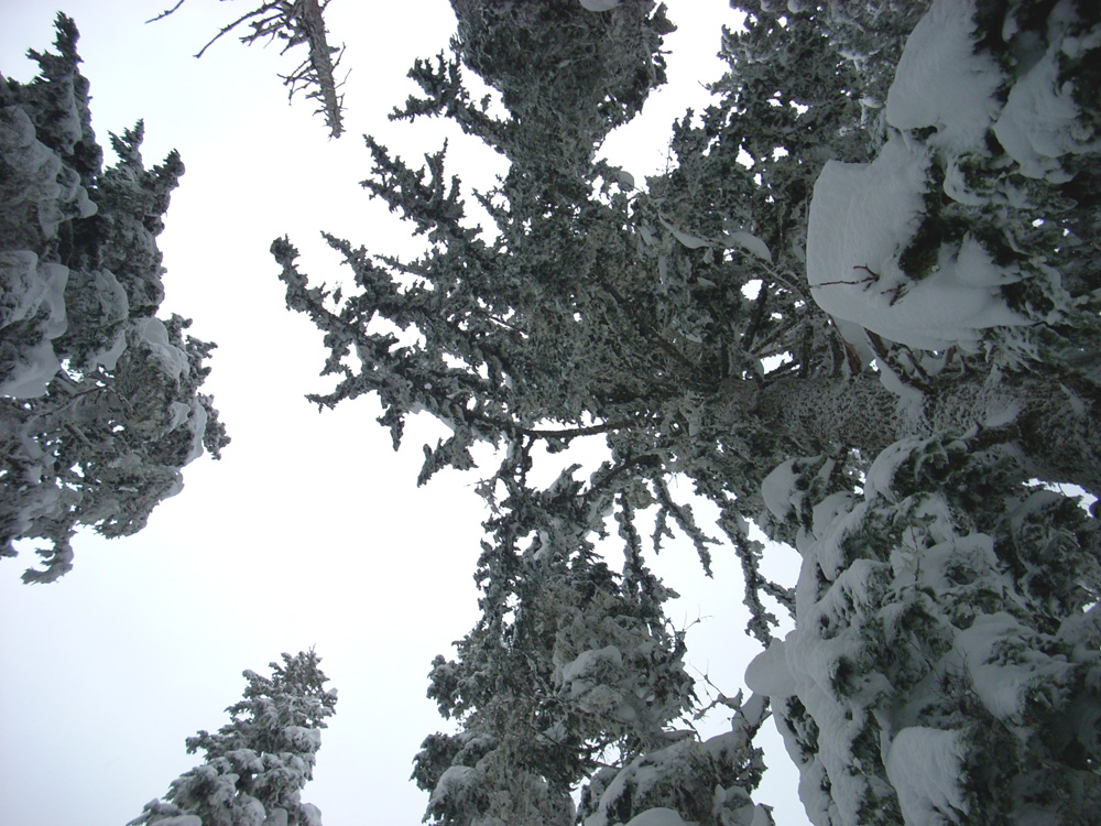
    The long delay in traffic slowed our plans so we stopped at the Snow Bunny recreation area which is one of the first good trail heads past Timberline. From there, we headed north on the Snow Bunny trail, then east on the Yellowjacket trail, and then back south to the parking area using the Whiteaway trail. It snowed for much of the trek but once we got into the trees then winds calmed. For much of the yellowjacket, and all the Whiteaway trail, there had been no one on the trail for a day or so, which allowed us to break trail through fresh snow. I am guessing the base there is about 100 inches, and in the airy snow I was often sinking 12 inches. Shoeing in powder is a little more effort than the packed snow. This increased effort seems to make up for the fact that our snow shoe hikes are so much shorter than our trail hikes, and it also makes the gray, high 20 degree weather just a little more enjoyable. As usual, we started off prior to lunch, then hiked to a good spot with a view to sit and have a bite, then continue on. All told, it was likely a 4 mile hike. Don’t really know how long it took, as long as we time it to be back well before dark, the time isn’t that important.

    Oregon Share the Road License Plates out Jan 2nd!

    Oregons new “Share the Road” auto plates designed to promote and protect bike riders and pedestrians will be released in January 2008.

    Oregon Share the Road License Plate

    To receive the new plate:

    • Write ‘I want the Share The Road plate’ on your renewal notice and send it in with an additional $10 above your regular renewal fee.
    • If you’re between renewals, you can order the plate anytime after January 2 online at OregonDMV.com or through a DMV office, for a $15 replacement plate fee plus the additional $10.

    Here at GoLiNiel, we will be ordering our plates for both cars the first week in January. No need to wait around for the plates to expire.
    (yes, two cars, sadly we can’t ride our bikes all the time.)

    Note to Family members: GoLiNiel can pay the initial registration fees for any family member who would like one of these plates.
    Mail GoLiNiel
    for arrangements.

    From BikePortland.org » Oregons new Share the Road license plate

    For more information download the press release (PDF).


    Many simple tools for biking vs a single unit?

    We like to ride our bikes a lot. And when we ride we have a need for a lot of input. That input helps fufill our needs of safety, planning, fitness and my compulsive need of data collection.
    A short list of some equipment we currently use to meet our needs:

    • Take a look mirrors are a small square mirror that fits on the glasses. Essential for monitoring traffic and what is going on behine you without taking your attention away from what is going on in front of you.
    • Polar heart rate monitors keep us informed on our levels of exertion and fitness.
    • Any simple cyclometer for data such as mileage, speed, times, etc. Honey likes the ones from Planet Bike. The larger display is easy to read in low light conditions, the “no buttons” design is easy to use. Plus it has a thermometer, which she delights in calling out on those days that may be bitterly cold, or blazing hot.
    • The Shimano STI shifters are simple, dependable and easy to use. But you still have to look back down to the chain rings to verify positioning, especially if you shift as much as I do.
    • We carry handlebar bags, for many gadgets like phone, camera, bars, etc. These bags also have a clear plastic pouch Honey likes to use for a map. She prefers to have clear and accurate data available to her about where she is and where she is going. I have developed a simpler and cheaper solution. A paper binder clip you can find on just about anyones desk, secured to the handlebar stem with a plastic zip tie, is a cheap, durable and dependable map holder.

    Alright, these are all good things. Fairly cheap and simple.

    But then again, I could get rid of all those things and go the route of the Cerevellum. Lets see, it is one cyclometer unit with plug in modues with the following features:

    • 3.5 inch LCD display
    • Hindsight – rear view digital camera with bar end or seat post mounted lens
    • 32 mg ram – to calculate and store data
    • GPS mapping – to map out any course, and allow me to wander aimleslly, while Honey keeps track of where we are.
    • Power Meter – to monitor and track your exertion and power output levels
    • Flight Deck shifting integration – to electronically shift and display gearing, without having to look behind you to confirm gearing.
    • Hear rate monitor to track fitness and exertion levels.
    • All the usual Cyclometer data

    Cerevellum

    This thing basically has all our input/output needs covered in one handy little unit!
    Hmmm, it is almost Chrismas………

    via Bike Commuters

    Another Danish bike safety implemtation U.S. will never see.

    Treehugger has a post on RFID Lights Up The Blind Spot .

    Basically, a sensor can be placed in a bike, so that when a cyclist approaches the intersection, the RFID sends a signal to the traffic light which turns on a flashing ‘cyclist’ sign at eye height to warn drivers, especially drivers of big rigs, that they should check for bikes before making a right-hand turn.

    Denmark considers it cost-effective to keep cyclists safe, as each serious accident or cyclist death costs the state as much as 1.7 million Danish crowns (US$300,000). Installation of the diodes and sensor at an intersection costs about 200,000 crowns (US$38,000)

    Hmmmm, does that just make too much sense, or do we just not care?